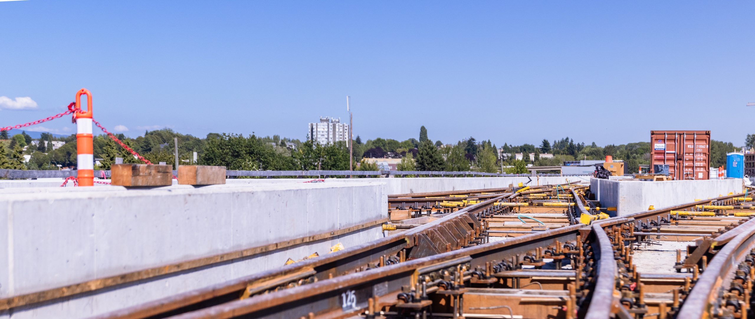
Parking and Access Maps
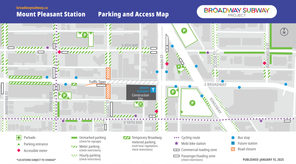
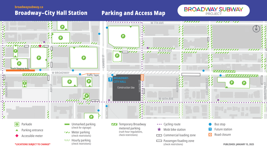
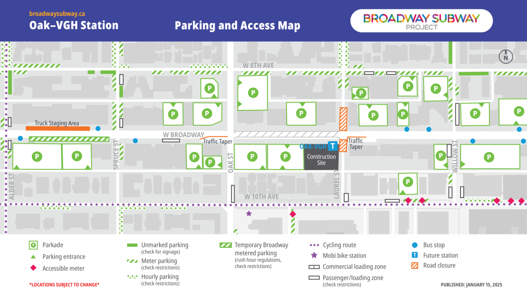
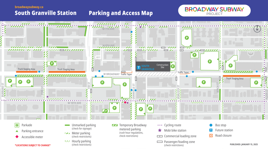
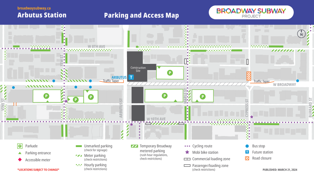
In collaboration with key partners, the Broadway Subway Project has developed alternative parking and access maps for the station areas along the Broadway corridor. Listed locations, including bus stops, are subject to change. Transit users are encouraged to check TransLink’s Trip Planner for updated locations of bus stops.
To download and print, click on a map, then right-click and select “save image as…”
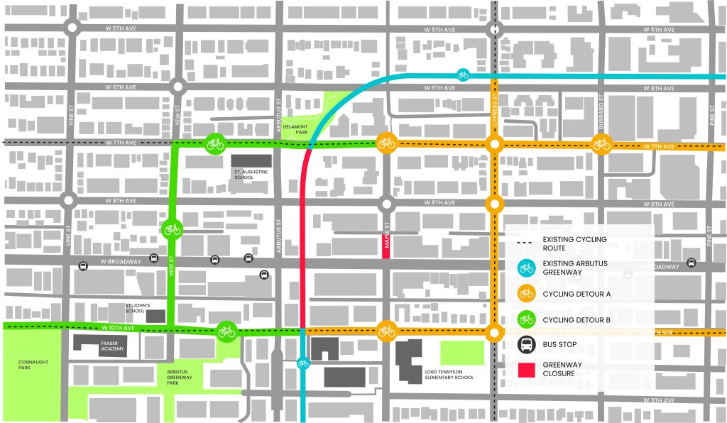
Greenway Detours

Additional Map Resources


Interactive Project Map
Click “L” for Legend


